Question 1
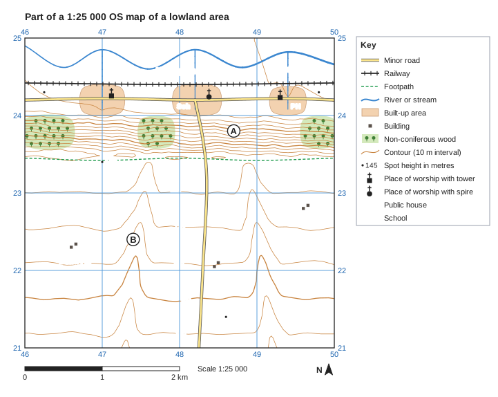
1 markFigure 1 is part of a 1:25 000 OS map of an imaginary lowland area, written for this course. The higher land in the south of the map is chalk.
Identify the type of valley at B.
Model answer
A dry valley.
Explanation
The contours at B form V shapes pointing up the valley, but no river or stream is shown in it. Valleys like this on permeable chalk are dry today; many formed when the ground was frozen in cold periods, so water flowed over the surface. A common error is to call it a V-shaped river valley without noticing that there is no stream.
Mark scheme
-
1 mark
Dry valley
Accept dry valley (including 'a dry V-shaped valley' or 'a valley with no stream in it'). Map evidence (not required): at B (474224, about 157 m) the contours bend into V shapes pointing up the valley, but no stream is shown, on permeable chalk. Do not accept 'V-shaped valley', 'river valley' or 'valley' alone, U-shaped valley, gorge or flood plain. All other answers are incorrect.