Question 1
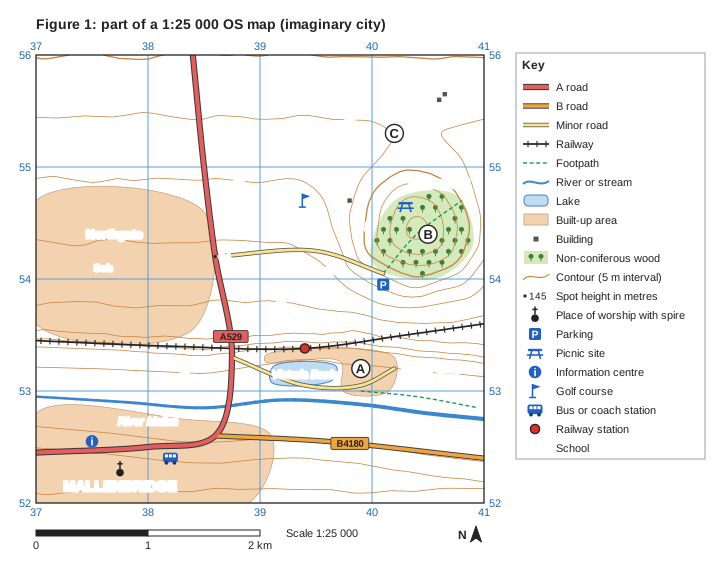
1 markFigure 1 is part of a 1:25 000 Ordnance Survey (OS) map of an imaginary city, written for this course.
Identify the main land use in grid square 3754.
Choose your answer.
- A Woodland
- B Built-up area (housing)
- C Water
- D Open farmland
Model answer
B
Explanation
Square 3754 is the square whose bottom-left corner is at easting 37, northing 54. Most of it is shaded as a built-up area (Northgate, with a school), so its main land use is housing. A common error is to read the northing first and look at square 5437 or the wrong row.
Mark scheme
-
1 mark
B (Built-up area (housing))
Accept the letter or the option written out; do not credit more than one answer. Square 3754 is mostly shaded orange-brown as the built-up area of Northgate, with a school. A is incorrect: the woodland (Hatch Wood) is in square 4054. C is incorrect: the water (Victoria Basin and the River Mallen) is in the south, e.g. squares 3953 and 3852. D is incorrect: open farmland (white) is in the north and east, e.g. squares 3955 and 4055. All other answers are incorrect.