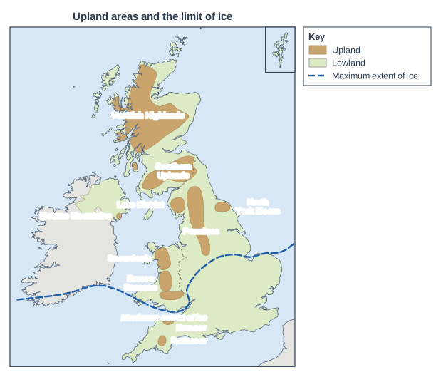
Figure 1 shows the upland areas of the UK and the maximum extent of ice during the last ice age.
Using Figure 1 and your own knowledge, explain how ice affected the landscapes of different parts of the UK.
Model answer
Figure 1 shows that during the last ice age ice covered most of the UK, including almost all the upland areas such as the Scottish Highlands, the Lake District, the Pennines and Snowdonia. Only the far south, including Dartmoor and Exmoor, lay beyond the limit of the ice.
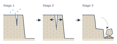
In the uplands the ice was thickest, and glaciers flowed downhill from the mountains. Here erosion was the main effect: plucking and abrasion, helped by freeze-thaw weathering, carved out corries, arêtes and pyramidal peaks, and turned river valleys into steep-sided glacial troughs with ribbon lakes and hanging valleys. The Lake District and Snowdonia are good examples of these eroded landscapes.
In the lowlands within the ice limit, such as parts of the Midlands and northern England, the ice was carrying enormous amounts of eroded debris. As it melted, it deposited this material, covering large areas in till (boulder clay) and leaving drumlins, moraines and erratics. Meltwater streams near the edge of the ice deposited sorted outwash.
South of the limit, places like southern England and Dartmoor were never covered by ice during the last ice age, so they have no glacial landforms. However, they had a very cold climate, so freeze-thaw weathering was still active. Overall, the ice mainly eroded the uplands of the north and west and covered the lowlands with deposits.
Explanation
Use the map to divide the UK into eroded uplands, lowlands covered with glacial deposits, and the ice-free south. Level 3 answers explain why each area was affected differently and name real places as evidence.